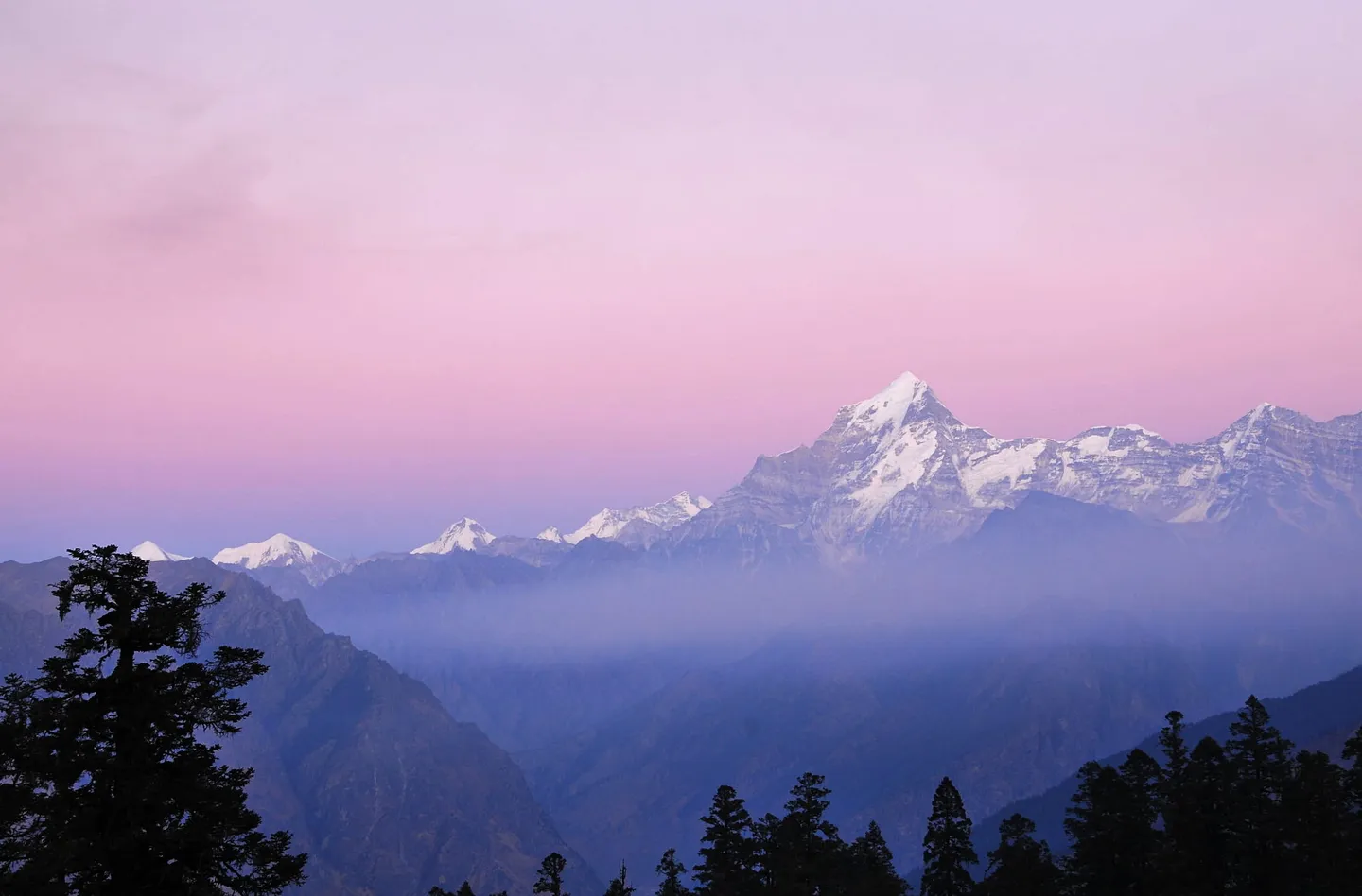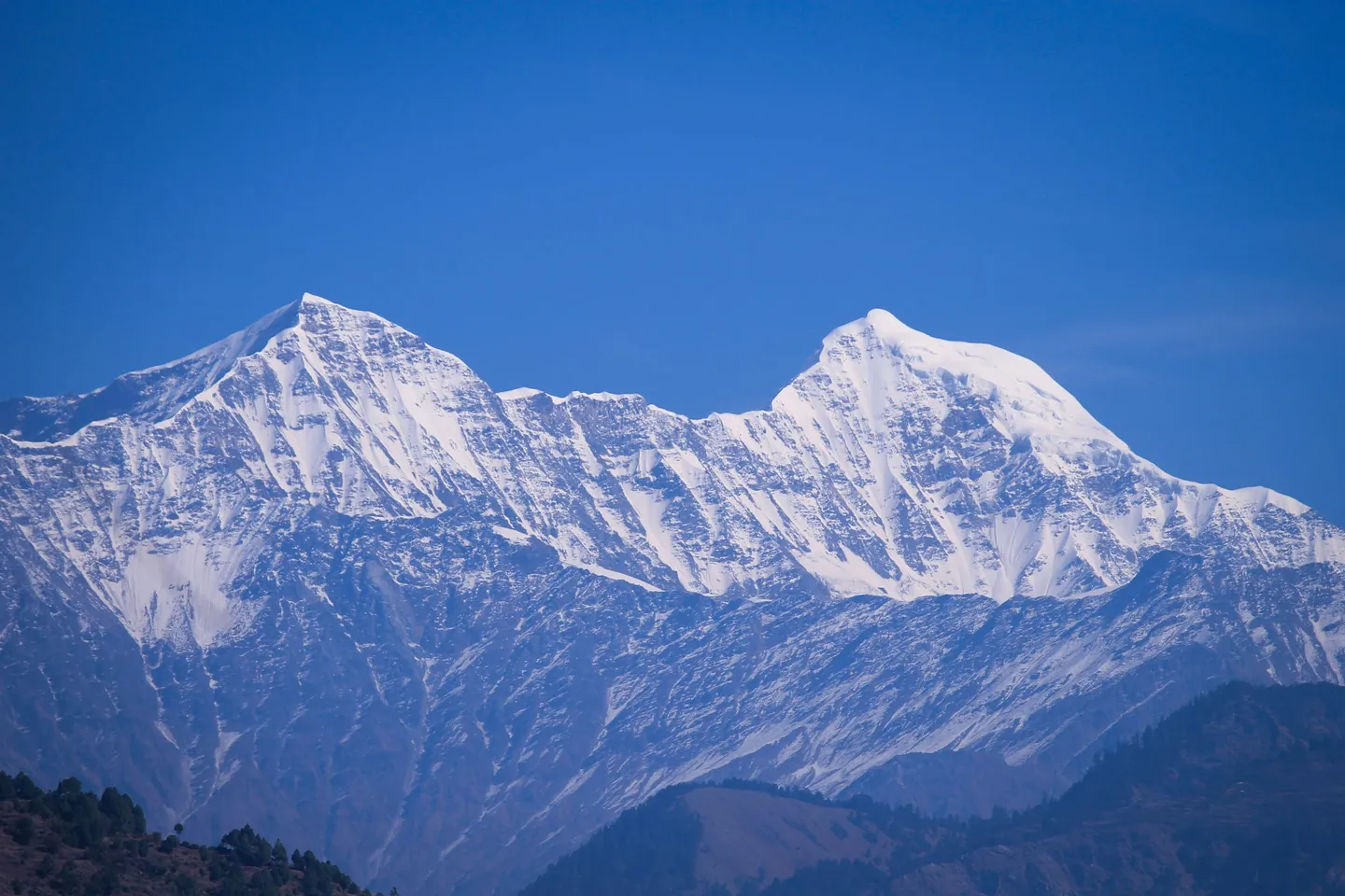
[PHOTO: Kuari Pass Trek, Chamoli]
Trek · Uttarakhandट्रेक
Dayara Bugyal Trek
Dayara Bugyal Trek is a 4-day Moderate trek in Uttarkashi, Uttarakhand, for fit first-timers and repeat adventurers. It starts any day you choose between 11 Nov 2026 and 28 Feb 2027, 4 days from the day you pick. It costs from ₹7,349 per person, including all taxes. It is run by Bharat Outdoors, a verified operator. Information last verified 21 Aug 2026. Every departure is booked online.
- Region
- Uttarakhand
- Base
- Uttarkashi
- Duration
- 4 days
- Grade
- Moderate
- Type
- Trek
- When
- Starts any day you choose (11 Nov – 28 Feb)
- From
- ₹7,349 per person, incl. all taxes
- Distance
- 22 km, 14 mi
- Max elevation
- 3,650 m, 11,975 ft
- Elevation gain
- 1,510 m, 4,954 ft
- Walking hours per day
- 3–9 hrs
- Start altitude
- 2,140 m, 7,021 ft
Information last verified · 21 Aug 2026
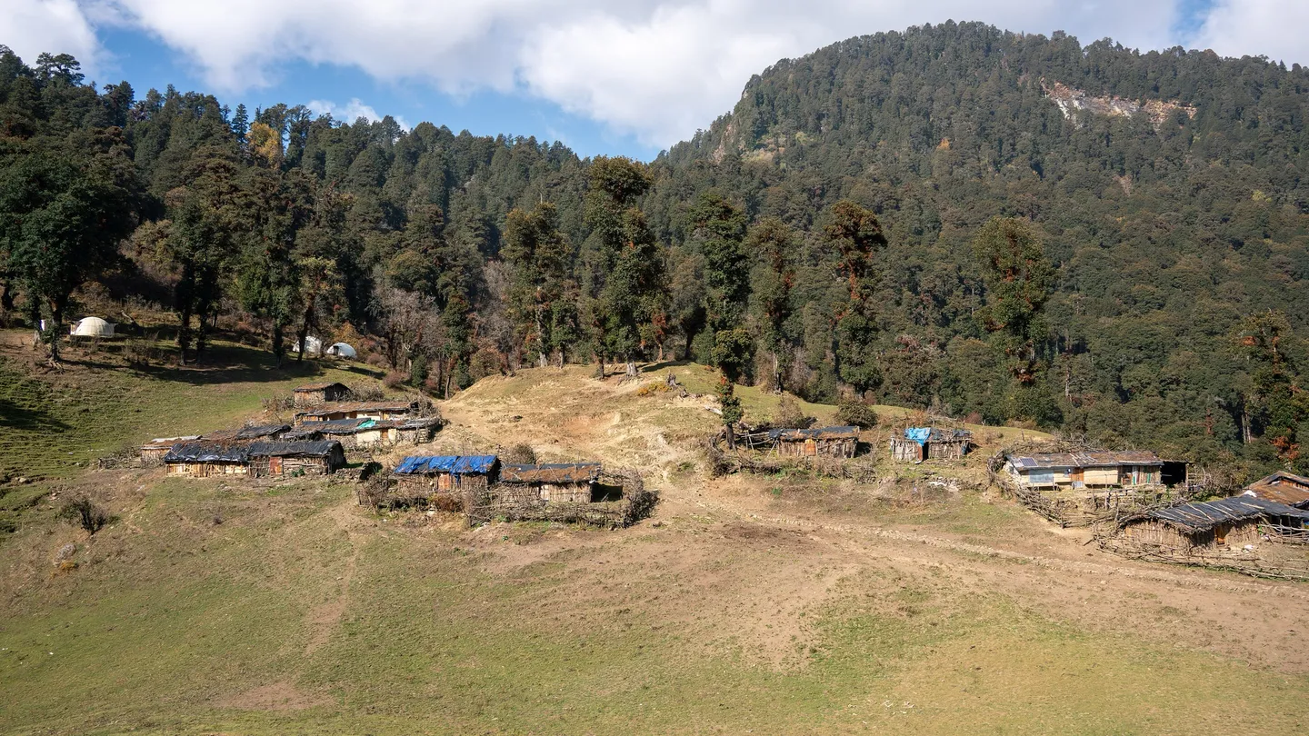
[PHOTO: Dayara Bugyal Trek, Uttarkashi]
- Verified operator
- Certified guides[1 : 8] ratio
- Money protectedheld until your trip starts
- Ratingsfrom completed trips only
The trek, in our words हमारी ज़ुबानी
Dayara Bugyal is a very large alpine meadow on a broad shoulder above the Bhagirathi valley in Uttarkashi district, reached from the village of Raithal. The trek is deliberately gentle. From Raithal the trail climbs about 830 m through oak, maple and rhododendron to Gui, a forest camp just below the meadow, and the next morning it opens out onto rolling grass with the Gangotri group, Bandarpunch and Srikantha standing along the skyline. The one long day is the walk across the meadow to Dayara Top and back to Gui, twelve to fourteen kilometres of easy-angled walking at around 3,400 to 3,650 metres. This is genuinely one of the better first Himalayan treks: nothing is exposed, nothing is technical, and the four-day version gives you a night at Raithal and a night at Gui, so you settle in at 3,000 metres before the long day instead of arriving at it fresh off the road. The meadow is not empty scenery, either. It is grazing land, and in mid-August the villages of Raithal and Barsu hold Anduri Utsav, a butter festival celebrating the cattle's return. In winter the same slopes hold deep, uncomplicated snow, which is what most people come for.
- Raithal village above the Bhagirathi, and the oak, maple and rhododendron forest the trail climbs through out of it.
- Gui, the forest camp just below the meadow, where the canopy first breaks and the meadow edge appears above.
- The Dayara meadow itself — one of the largest high meadows in Garhwal, rolling for kilometres at 3,400-3,650 m, under snow in winter and in flower from May.
- Dayara Top at about 12,000 ft (3,650 m), the high point of the long day across the grassland.
- The Gangotri group, Bandarpunch and Srikantha on the skyline — a full Garhwal panorama from a trek with only one long day.
- Working shepherd country: this is a grazing bugyal, and in season you will share it with flocks and their herders.
What the price covers कीमत में क्या शामिल है
| Item | Details |
|---|---|
| Included |
|
| Trek fee | ₹6,999 per person, for 4 days. |
| GST (5%) | ₹350 per person, included in the price. |
| Total | ₹7,349 per person. Trek prices are per person and include all taxes. What you see is what you pay: no booking fee or registration fee is added at checkout. |
| Cancellation | Full refund until 30 days before departure, 50% until 15 days before, none after. Refundable add-ons: full refund before the trek starts. |
How to prepare तैयारी
- Preparation
- Drink 3 to 4 litres a day. The climb to Gui on Day 2 is the fast gain on this trek, so go slowly, and use the afternoon and evening at Gui to walk up 100 m and come back rather than resting flat; that first night at Gui is the only acclimatisation this plan gives you before the long day. Avoid alcohol and sleeping tablets. Report headache when it starts. Ask your trek leader how they check for altitude illness, with a daily pulse oximeter reading, and whether emergency oxygen travels with the group. If symptoms are not improving, or there is confusion, loss of balance, breathlessness at rest or a wet cough, descend. On this route descent is unusually quick, because Raithal is only a few hours below Gui.
- Know before you go
- Sources grade this trek Easy to Moderate (five pages) or Easy (two); we list the sourced consensus, Easy-Moderate. The climb to Gui on Day 2 and the long meadow walk on Day 3 are what decide it. See the sources below.
- Uttarakhand Forest Department, Uttarkashi Forest Division. Fees are collected and trekkers registered at the forest check post at Raithal or Barsu; no state tourism or district magistrate clearance is required for Indian nationals.
- Build for four weeks. A workable target is a 45 minute brisk walk with 300 m of ascent, three times a week, plus one longer walk of 12 km or more before you go so that Day 3 is not the longest walk of your life. Add stair or hill repeats with a 5 to 8 kg pack. Because Days 2 and 4 are only 4 to 5 km each, the limiting factor for most people is Day 3 and the steep forest descent, not cardiovascular capacity. This is a reasonable trek for a fit beginner, for older trekkers with medical clearance, and for children of around 10 and up with individual assessment.
- Two realistic scenarios and one seasonal one. First, a whiteout on the bugyal: the meadow is large, rolling and almost featureless, and in fresh snow or thick cloud a group that spreads out can lose the trail and each other. This is by some distance the most likely way this trek goes wrong. Second, an unsheltered afternoon storm on Day 3's meadow walk, which in summer means lightning on open high ground and in winter means hypothermia. Third, the approach road in monsoon. Altitude illness is a genuine but low risk here, and it would be dishonest to present this trek as more dangerous than it is: the honest summary is that Dayara is a safe trek with one navigational hazard that people underestimate because the grade says Easy.
- Getting there
- Nearest railhead: Dehradun (DDN), approximately 175 to 192 km from Raithal by road, 7 to 9 hours via Mussoorie, Chinyalisaur, Uttarkashi and Bhatwari, and about the same back on Day 4. Nearest airport: Jolly Grant, Dehradun (DED), approximately 200 to 218 km from Raithal, 8 to 10 hours by road. The airport is about 25 km from Dehradun city, so add that to any distance quoted from the railway station. Basecamp: Raithal (roughly 7,000 to 7,400 ft / 2,140 to 2,260 m), Bhatwari block, Uttarkashi.
Safety सुरक्षा
Every adventure carries risk. This is what has been done to reduce it, and what has been checked.
- Known hazards
- A featureless open meadow in cloud or fresh snow, where the trail disappears and navigation becomes genuinely non-trivial. This is the specific hazard of Dayara and the reason a local guide matters more here than the easy grade suggests; No shelter of any kind on the bugyal for the whole of Day 3, so a hailstorm or thunderstorm means walking through it; Steep, root-laced forest trail between Raithal and Gui, slippery when wet and hard on knees on the descent; Soft, wet snow on the meadow in March and April that conceals uneven ground and drainage channels; post-holing here twists ankles; Deep unconsolidated snow in January and February that turns the 12 to 13.6 km Day 3 into a much longer one than the itinerary allows for; Grazing land, so livestock, dogs and shepherd huts along the route; give animals room and do not approach guard dogs; Landslide-prone approach road along the Bhagirathi through Bhatwari, especially in monsoon Self-declared
- Best season
- This is close to a year-round trek and each window offers something different. December to February is the snow season, with the meadow under continuous cover from late December, day temperatures around minus two to eight and nights of minus ten to zero; it is the most popular window and the most demanding underfoot. The snow does not always arrive on schedule: one page puts the first snowfall in the second or third week of December, with the meadow fully white from late December to February and often knee-deep after fresh snow, and another puts January at about 4 C by day and minus 11 C at night at Gui, below the meadow. March and April give residual snow on the meadow with a clearing forest below and the rhododendron out, at 10 to 18 C by day and around freezing at night. May and June are the green-and-flowers window at 15 to 20 C by day with nights above freezing, and are the easiest for a nervous first-timer. September to November, once the monsoon withdraws, gives the clearest views of the Gangotri group and Bandarpunch with cold, dry nights. There is no month that is obviously wrong except the monsoon. Self-declared
- Maximum altitude
- About 12,000 ft / 3,650 m — Dayara Top, the high point of Day 3. This is the least well-defined figure on the trek because Dayara is a broad rolling meadow with several named high points rather than a summit. Published figures for the high point run from 11,181 ft (3,408 m), which is the meadow rather than the top, through 3,639 m (Wikipedia) and 3,640 to 3,660 m on most trek pages, up to 3,780 to 3,810 m, which is Bakaria Top. OpenStreetMap tags the peak named Dayara at 3,651 m and a terrain-tile elevation model reads about 3,656 m there; the same data tags Bakria at 3,804 m. So the meadow lies at about 3,400 to 3,500 m, Dayara Top at about 3,650 m, and the separate Bakaria Top at roughly 3,800 m, about 1.5 km south of Dayara Top in a straight line. This plan turns round at Dayara Top and does not go on to Bakaria Top. Self-declared
- Getting there
- Railhead Dehradun (DDN), approximately 175 to 192 km from Raithal by road, 7 to 9 hours via Mussoorie, Chinyalisaur, Uttarkashi and Bhatwari, and about the same back on Day 4; airport Jolly Grant, Dehradun (DED), approximately 200 to 218 km from Raithal, 8 to 10 hours by road. The airport is about 25 km from Dehradun city, so add that to any distance quoted from the railway station. Self-declared
- Difficulty
- Short days, gradual gradients, a well-defined trail and no exposure anywhere. Two of the three walking days are 4 to 5 km. The single demanding day is the 12 to 13.6 km round trip from Gui across the meadow to Dayara Top, which is long but easy-angled. The climb to Gui on Day 2 gains about 830 m in 4 to 5 km, the steepest sustained gain on the trek. You sleep at Gui, roughly 2,950 to 3,000 m, and walk to about 3,650 m, so altitude illness is possible but the profile is unusually kind. Independent grades: two trek pages call it Easy and five call it Easy to Moderate. Easy-Moderate is the consensus label and is fair. Winter changes the effort more than the grade: deep snow on the meadow makes Day 3 considerably slower. Self-declared
- Safety equipment
- 50 to 60 litre backpack with a padded hip belt and a rain cover if you carry your own load, or a 20 to 30 litre daypack if you offload to a mule; Sleeping bag with a comfort rating of about minus 10 C for March and April. Most operators supply one; confirm the comfort rating, not the extreme rating; Sleeping mat with an R-value of 3 or better if you supply your own, and 4 or better if you are going in January; 2 x trekking poles. The descent from Gui to Raithal is the steepest sustained section on the trek and is where knees complain; Microspikes for March and April snow on the meadow, mandatory in deep winter. Several operator pages list microspikes as essential in winter here; confirm whether your operator supplies them; Headlamp with fresh batteries and a spare set Self-declared
- Guide requirement
- Uttarkashi Forest Division forest entry permit and trail registration. Arranged by your operator. Issued by Uttarakhand Forest Department, Uttarkashi Forest Division. Where: Forest check post at Raithal or Barsu, paid in cash on the day. This is open forest land rather than a national park, and one detailed secondary source states plainly that no formal trekking permit is required for Indian nationals and no Inner Line Permit or district clearance applies. What is required is a forest entry fee, reported at approximately INR 50 to 100 per person per day for Indian nationals and INR 300 to 600 per person per day for foreign nationals in 2026, payable in cash at the check post, plus registration of the group's names, ID, emergency contacts, intended route and campsites, and expected return date. One trek page separately reports a foreign-national levy of INR 1,200, which is likely to be a company charge rather than the government tariff. No Forest Department notification could be read directly, so treat these figures as indicative and carry more cash than you expect to need. Camping rules and designated campsites. Arranged by your operator. Issued by Uttarakhand Forest Department (Uttarkashi Division), under the statewide bugyal orders. Where: The Dayara meadow and the forest campsites below it. In August 2018 the Uttarakhand High Court banned overnight stays on the state's alpine and sub-alpine meadows and capped visitors at 200; the order applied statewide, Dayara included. Trekking reports from July and August 2026 say the Supreme Court set those directions aside on 20 July 2026 and left the rest in force (no permanent structures, no commercial grazing, waste removed, no new encroachment); we could not read the judgment, so ask what the range office is enforcing this season. Reported permitted campsites are Barnala Tal and the Dayara meadow. One trek page says the opposite for the meadow itself: that camping is not permitted directly on it, and that overnight stays are allowed only at the forest campsites just below it, such as Gui or Barnala Tal. This 4-day plan does not depend on either reading: its nights are at Raithal and at Gui, a forest camp below the meadow, and the meadow is walked by day. Tents must be pitched at least 30 m from any water source, no trenching is allowed, open fires on the meadow are prohibited and cooking must be on gas, and the carry-in carry-out rule is enforced. Guide requirement. Issued by Uttarakhand Forest Department (advisory rather than mandatory). Where: Raithal / Barsu. Unlike Govind Pashu Vihar on the Sankri side, solo trekking on Dayara is reported as permitted, with a strong advisory that first-time high-altitude trekkers go with a registered operator. Given that the specific hazard on this trek is navigation across a featureless meadow in cloud or fresh snow, that advisory deserves more weight than the Easy grade implies. Self-declared
- Emergency evacuation
- An unusually short evacuation profile for a Himalayan trek. Dayara Top is roughly 10 to 11 km on foot and about 1,500 m above Raithal, realistically 4 to 6 hours for a walking casualty and a long but feasible day for a carry. From Gui, Raithal is 4 to 5 km downhill. Raithal is on a motorable road. The nearest hospital is the community health centre at Bhatwari, about 12 km away, with the District Hospital at Uttarkashi roughly 32 to 45 km depending on which figure you use. Full trauma and ICU capability means Dehradun, 6 to 8 hours by road. The state ambulance line is 108. Helicopter evacuation is possible in principle from the open meadow, which is one of the few places on any of these treks where a landing site is not the problem, but it remains weather- and daylight-dependent and must be arranged through the district administration or a private operator against payment. Buy insurance that covers trekking and evacuation. Self-declared
- Fitness prerequisite
- Build for four weeks. A workable target is a 45 minute brisk walk with 300 m of ascent, three times a week, plus one longer walk of 12 km or more before you go so that Day 3 is not the longest walk of your life. Add stair or hill repeats with a 5 to 8 kg pack. Because Days 2 and 4 are only 4 to 5 km each, the limiting factor for most people is Day 3 and the steep forest descent, not cardiovascular capacity. This is a reasonable trek for a fit beginner, for older trekkers with medical clearance, and for children of around 10 and up with individual assessment. Self-declared
Information last verified · 21 Aug 2026
Gear checklist सामान
Questions people ask सवाल-जवाब
Is Dayara Bugyal an easy trek?
In June, yes — it's at the easy end of anything sold in Garhwal, and family batches run on it. Two things stop it being simply Easy in general: the opening climb out of Raithal gains about 830 m (2,700 ft) in 4 to 5 km, the steepest gain rate on the trek, and the long day to Dayara Top is, in winter, often on knee-deep snow. The honest label is Easy-Moderate.
When should I go to Dayara Bugyal — for the flowers or the snow?
These are different trips at the same coordinates. The meadow blooms roughly mid-May to late June with warm days and light nights; the snowscape runs late December to February, with the meadow fully white and often knee-deep after fresh snow, days around 0 to 4 C on the meadow, nights at Gui falling to about minus 7 to minus 11 C, and microspikes and gaiters needed; early December can still be patchy, since one page puts the first snowfall in the second or third week of that month; September-November gives no flowers and no snow but the clearest mountain views of the year. Decide which trek you want before you pick a month — the kit lists don't overlap.
What permit does Dayara Bugyal need?
A forest entry and trekking permit from the Uttarakhand Forest Department's Uttarkashi Forest Division, normally completed on arrival in Raithal by your operator. It's a standard forest permit rather than a national-park ticket, since Dayara isn't inside a protected park. If you're 50 or over, Uttarkashi district practice is reported to make a medical fitness certificate mandatory here, even though this is one of the district's easier routes.
Is altitude sickness a concern on Dayara Bugyal?
Low to moderate: the high point is about 12,000 ft and you sleep no higher than Gui, around 9,700 to 9,850 ft. It is still flagged that the Raithal-to-Gui section, which climbs about 2,700 ft in 4 to 5 km, is a fast first-day gain rate where AMS is a real possibility for anyone. Treat the afternoon and first night at Gui as the acclimatisation: walk up a little and come back rather than resting flat, and report a headache early.
What's easy to get wrong packing for Dayara Bugyal?
Carrying a winter kit list in June or a summer kit list in January — the temperature and gear needs here are unusually far apart for one trek. In summer, underestimating water and sun protection is the real hazard: there's no water source on the open meadow, Day 3 is 12 to 13.6 km, and sunburn is the most common minor injury on a June departure. In winter, gaiters and microspikes become mandatory as the snow reaches knee depth.
How far is Dayara Bugyal's trailhead from Dehradun?
About 175 to 192 km to Raithal village, roughly 7 to 9 hours by road via Dhanaulti or Mussoorie, Chinyalisaur and Uttarkashi. Uttarkashi town, about 45 km and 1.5 to 2 hours below Raithal, is the last point with a district hospital and reliable pharmacies, so it's worth treating as your last checkpoint for anything you've forgotten before the mountains.
Why do different sources give such different altitudes for Dayara Bugyal's high point?
Because "the altitude of Dayara Bugyal" gets used for three different things: the meadow surface itself (about 3,500 m), Dayara Top on the standard Raithal itinerary (3,639-3,651 m), and Bakaria Top, a genuinely higher, separate point at about 3,804 m (12,480 ft) that is not on this 4-day plan. If you see "12,500 ft" quoted, that's almost certainly Bakaria Top, not the point you'll actually stand on.
Can I camp on Dayara Bugyal, and does this plan?
Overnight stays on Uttarakhand's bugyals were banned by the High Court in 2018. Trekking reports from July and August 2026 say the Supreme Court set that ban aside on 20 July 2026, but we could not read the judgment, and at least one trek page still says camping is not permitted on the meadow itself. This plan does not depend on it: the nights are at Raithal and at Gui, a forest camp below the meadow, and the meadow is walked by day.
Book this trip
from₹7,349per person · incl. all taxes
Trek fee ₹6,999 + ₹350 GST
Add-ons
Optional- TransportRoad transport from Dehradun Railway Station to Raithal at 06:30 on day 1, and back on the evening of day 4. Book it by the evening before.
Choose these when you book. You can add more later, until the trek starts.
Payment protected — held until your trip starts.
Dates and payment are handled on MadClub.
Cancellation: Full refund until 30 days before departure, 50% until 15 days before, none after. Refundable add-ons: full refund before the trek starts.
Information last verified · 21 Aug 2026
from · Any day · 11 Nov – 28 Feb · incl. all taxes₹7,349
Book on MadClubPayment protected — held until your trip starts.
Reviewsसमीक्षाएँ
Reviews from verified bookings
No reviews yet. Reviews come only from people who completed the trip.
More adventures
All adventures- Moderate
- Hard
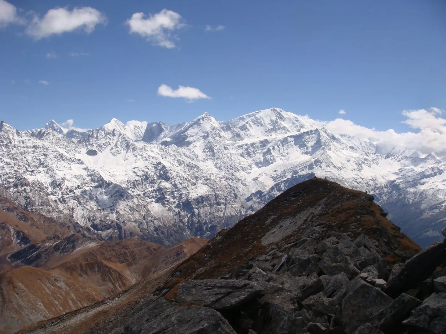
[PHOTO: Pangarchulla Peak Trek, Chamoli]
- Moderate
[PHOTO: Gulabi Kantha Trek, Uttarkashi]